Maps of Mesopotamia

Empires. Cultural
Centers. Cities.
This first map below shows the approximate location of each of the empire's capitol city as discussed on this web site. The actual acreage of each empire but not shown here ebbed and flowed with the political and military events of the times. The Sumerians, Akkadians, Babylonians and Assyrians are the main Mesopotamian players. To the north would be the Hittites, Hurrians, Mitanni, Subarians and later the Urartians. To the east would be the Elamites and the southwest the Egyptians.

The
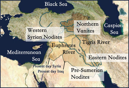
Nodite and Vanite Centers
The Lucifer Rebellion was a
harbinger of the confusion and discord to be sown among the Nodites.
First was the main split between those who chose which side to be on.
Then later the rebels fell to quarreling with each other and further
fractured into three more smaller groups. If one looks at the four
locations you will see that this is where the earliest indications of
culture and civilization are located.
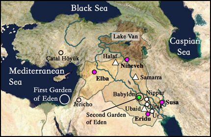
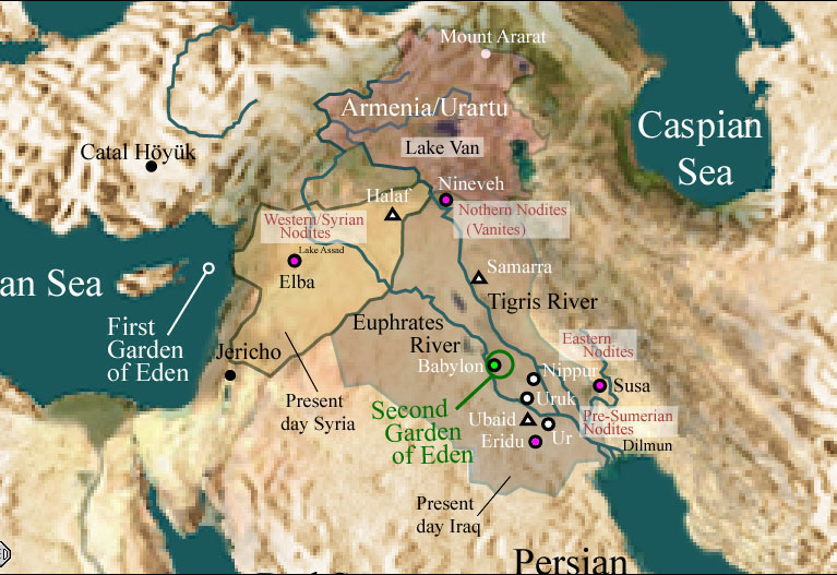
Cities
This
third map below shows the location of: 3 of the main Sumerian cities
(white circles), 3 Pre-Sumerian culture centers (white triangles), 4
cultural areas (pink circles), Babylon and the
location of the first and second gardens.
If we look at the four centers we find some of the oldest urban cities. Elba in Syria, Eridu in southern Sumeria, Susa in Elam and Nineveh in northern Mesopotamia. Jericho is also very old, maybe the oldest continuously occupied city but it is not Sumerian.
Cuneiform tablets have also been found in Eblaite (a Semitic language from northern Syria), Elamite (from the area of modern Iran), Hittite (an Indo-European language spoken in ancient Turkey), and other languages throughout the ancient Near East. The Semitic invaders also brought in Akkadian and the Babylonian language.
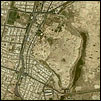
 Nineveh
"Prehistoric
occupation of the site dates back to at
least the 6th millennium BC."
(http://www.crystalinks.com/nineveh.html)
Nineveh
is just across the Tigris
from modern day Mosul.
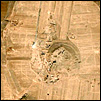
 Eridu
Eridu
"The
most southerly and possibly also the earliest city-state of Sumer
in southern Mesopotamia. A sounding excavated underneath a ziggurat of
the late 3rd millennium BC revealed a sequence of 18 religious
buildings. The earliest building was a simple mud-brick shrine resting
on virgin sand. By the time of its tenth rebuilding it had acquired the
standard form of the Sumerian temple with tripartite plan consisting of
a long central room flanked by symmetrically grouped side chambers and
was built on a substantial platform. The earliest phase of occupation -
named the Eridu Phase - is dated to circa 5000 BC"
(http://ancientneareast.tripod.com/Eridu_Period.html)
 Susa
Susa
"Susa,
derived from the word shushan, meaning "lily" in the ancient Semitic
tongues, is one of the oldest known settlements of the Mesopotamian
civilization, probably founded about 4000 BC. It is frequently
mentioned in the Old Testament of the Christian Bible and in the Jewish
Tanakh. The Hebrew prophets Daniel and Nehemiah lived in Susa during
the Babylonian captivity of the sixth century BC. Esther became queen
there and saved the Jews from genocide."
(From
Wikipedia, the free encyclopedia.)
 Elba
Elba
"Excavations
conclude that the Tell was occupied by its first residents
near 3500 BCE."
"It is
located at Tall Mardikh, this town flourished during the third
and second Millennium B.C. the archaeological diggings showed that its
royal palace, constructed in the third Millennium B.C. had been burned
and destroyed twice many clay tablets, which have been consolidated by
fire, have however been discovered there, including one considered as
the first bilingual dictionary in the world these tablets use cuneiform
script and are written in many languages."
(http://www.seabar.com/ebla.htm)
To put these dates in some kind of context, Moses in his exodus from Egypt was about c. 1300 B.C.
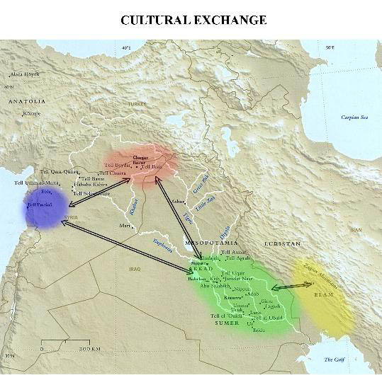
The map below shows the four centers of cultural exchange as today's archaeologists have determined them. I found this map after I made my own maps:
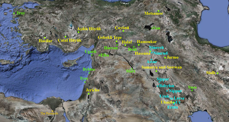
The
above map shows the locations of Sumerian and pre-Sumerian cities.
Pre-Sumerian cities are in Yellow.
There
were at this time Andites populating this area and they were already
making pottery, weaving textiles, growing crops, domesticating animals
and
involved in commerce. Click on the above map for a larger view. The
following page
The Old Ones gives more
information on these pre-Sumerian cities.
Almost all images of these
cities and tells are available on the Satellite Images page.

